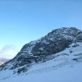
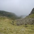
Round How photos
Round How

and licensed for reuse under this Creative Commons Licence

Hover over the map markers to see associated photo. Note, some markers show photographer's position whilst others show photo subject location.
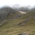
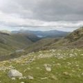
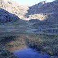
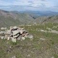
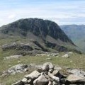
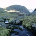
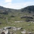
['Round How',54.4624,-3.20652,'/public/geophotos/1688363.jpg'],['Round How and Greta Gill',54.4626,-3.20652,'/public/geophotos/1705771.jpg'],['North from Round How',54.4622,-3.2079,'/public/geophotos/8494.jpg'],['Great Gable and Green Gable',54.4626,-3.20791,'/public/geophotos/2598544.jpg'],['Tarn Near Round How',54.4619,-3.20619,'/public/geophotos/328374.jpg'],['The summit cairn of Round How',54.4627,-3.20591,'/public/geophotos/842617.jpg'],['The summit cairn of Round How',54.4624,-3.20559,'/public/geophotos/842620.jpg'],['Greta Gill',54.4617,-3.20804,'/public/geophotos/328383.jpg'],['The summit of Round How',54.4623,-3.20512,'/public/geophotos/842621.jpg'],['Greta Gill',54.4621,-3.20882,'/public/geophotos/994019.jpg']