Beinn Bhuidhe photos
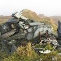
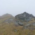
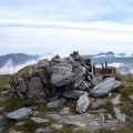
Summit cairn, Beinn Bhuidhe

and licensed for reuse under this Creative Commons Licence
Hover over the map markers to see associated photo. Note, some markers show photographer's position whilst others show photo subject location.
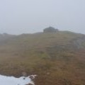
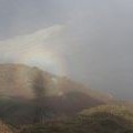
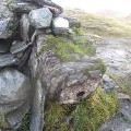
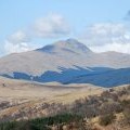
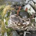
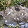
['Summit cairn, Beinn Bhuidhe',56.3267,-4.90671,'/public/geophotos/2691592.jpg'],['Summit clutter & cairn on Beinn Bhuidhe',56.3266,-4.9067,'/public/geophotos/2302149.jpg'],['Brocken spectre, Beinn Bhuidhe',56.3268,-4.90672,'/public/geophotos/2691600.jpg'],['Fallen triangulation pillar, Beinn Bhuidhe',56.3267,-4.90687,'/public/geophotos/2686542.jpg'],['Beinn Bhuidhe',56.3266,-4.90687,'/public/geophotos/1247806.jpg'],['Triangulation pillar, Beinn Bhuidhe',56.3266,-4.90687,'/public/geophotos/2686515.jpg'],['Top surface, Beinn Bhuidhe triangulation pillar',56.3266,-4.90687,'/public/geophotos/2686529.jpg'],['Remains of the trig on Beinn Bhuidhe',56.3266,-4.90654,'/public/geophotos/2302150.jpg'],['The deceased trig-point on the summit of Beinn Bhuidhe',56.3265,-4.90686,'/public/geophotos/534650.jpg'],['Beinn Bhuidhe (Munro) from Maol an Fhithich',56.3265,-4.90734,'/public/geophotos/1847477.jpg']