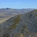
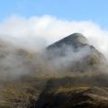
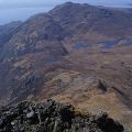
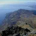
Beinn Sgritheall photos
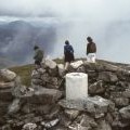
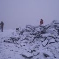
Summit trig point, Beinn Sgritheall

and licensed for reuse under this Creative Commons Licence
Hover over the map markers to see associated photo. Note, some markers show photographer's position whilst others show photo subject location.
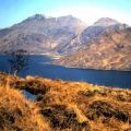
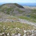
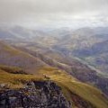
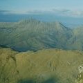
['Summit trig point, Beinn Sgritheall',57.1537,-5.57934,'/public/geophotos/2257269.jpg'],['Beinn Sgritheall viewed across Loch Hourn',57.1536,-5.57917,'/public/geophotos/1083703.jpg'],['Towards the northern top of Beinn Sgritheall',57.1549,-5.57963,'/public/geophotos/1981140.jpg'],['View from Beinn Sgritheall',57.1529,-5.5801,'/public/geophotos/637288.jpg'],['View east from Beinn Sgritheall',57.1537,-5.57852,'/public/geophotos/633332.jpg'],['Beinn Sgritheall',57.1539,-5.58102,'/public/geophotos/2970605.jpg'],['Western approach to Beinn Sgritheall',57.1536,-5.58132,'/public/geophotos/1104257.jpg'],['View west from Beinn Sgritheall',57.1539,-5.58151,'/public/geophotos/633330.jpg'],['Beinn Sgritheall',57.1531,-5.5811,'/public/geophotos/105906.jpg'],['Beinn Sgritheall from Ladhar Bheinn',57.1537,-5.57753,'/public/geophotos/1069562.jpg']