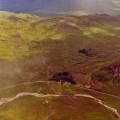
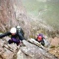
Buachaille Etive Mor - Stob Dearg photos
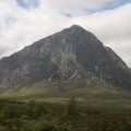
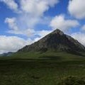
Buachaille Etive Mor from the A82 at Alnafeadh

and licensed for reuse under this Creative Commons Licence
Hover over the map markers to see associated photo. Note, some markers show photographer's position whilst others show photo subject location.
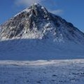
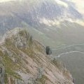
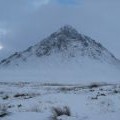
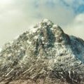
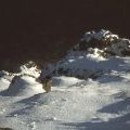
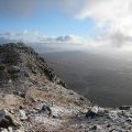
['Buachaille Etive Mor from the A82 at Alnafeadh',56.6462,-4.89994,'/public/geophotos/2601025.jpg'],['Buachaille Etive Mor',56.6467,-4.89981,'/public/geophotos/228005.jpg'],['Stob Dearg, Buachaille Etive Mor, from above!',56.6467,-4.89981,'/public/geophotos/2633202.jpg'],['Stob Dearg in January',56.6473,-4.89986,'/public/geophotos/1652120.jpg'],['Stob Dearg',56.6467,-4.89916,'/public/geophotos/765135.jpg'],['Stob Dearg',56.6473,-4.89934,'/public/geophotos/990840.jpg'],['Crowberry Tower from above',56.6457,-4.89843,'/public/geophotos/2231388.jpg'],['Near the summit of Buachaille Etive Mor',56.6467,-4.89818,'/public/geophotos/975529.jpg'],['View from Stob Dearg',56.6471,-4.89854,'/public/geophotos/1012292.jpg'],['On Curved Ridge',56.6475,-4.89727,'/public/geophotos/895282.jpg']