Carn Eige photos
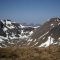
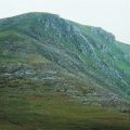
Carn Eige and Mam Sodhail

and licensed for reuse under this Creative Commons Licence
Hover over the map markers to see associated photo. Note, some markers show photographer's position whilst others show photo subject location.
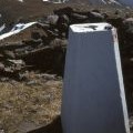
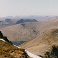
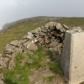
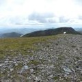
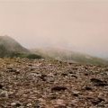
['Carn Eige and Mam Sodhail',57.2876,-5.1154,'/public/geophotos/1727369.jpg'],['Summit trig point, Carn Eighe',57.2876,-5.1149,'/public/geophotos/1727384.jpg'],['The ridge out to Beinn Fhionnlaidh',57.288,-5.11544,'/public/geophotos/2420401.jpg'],['Carn Eige',57.2877,-5.11608,'/public/geophotos/212489.jpg'],['Carn Eige from the east',57.2878,-5.11393,'/public/geophotos/1130338.jpg'],['Mam Sodhail from Carn Eige',57.2871,-5.11586,'/public/geophotos/881922.jpg'],['Màm Sodhail from Carn Eige',57.2872,-5.1162,'/public/geophotos/1133947.jpg']