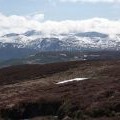
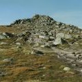
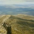
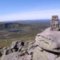
Lochnagar - Cac Carn Beag photos
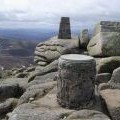
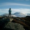
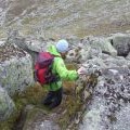
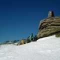
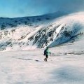
The summit of Lochnagar

and licensed for reuse under this Creative Commons Licence

Hover over the map markers to see associated photo. Note, some markers show photographer's position whilst others show photo subject location.
['The summit of Lochnagar',56.9601,-3.24528,'/public/geophotos/498984.jpg'],['Lochnagar from Culardoch',56.9604,-3.24513,'/public/geophotos/1774463.jpg'],['Carn Cac Beag',56.96,-3.24511,'/public/geophotos/2426593.jpg'],['View north from Carn Cac Beag',56.9603,-3.24479,'/public/geophotos/2426613.jpg'],['Summit of Cac Carn Beag (Lochnagar)',56.9599,-3.24544,'/public/geophotos/2793725.jpg'],['Cac Carn Beag',56.9602,-3.24578,'/public/geophotos/1973285.jpg'],['Cac Carn Beag of Lochnagar from Cnapan Nathraichean spur',56.9599,-3.24478,'/public/geophotos/2270548.jpg'],['Descending from the summit of Lochnagar',56.9602,-3.24397,'/public/geophotos/556321.jpg'],['Summit tor of Cac Carn Beag in February snow',56.9599,-3.24642,'/public/geophotos/2272792.jpg'],['Approaching Cac Carn Beag from the Stuic',56.9599,-3.24642,'/public/geophotos/2272891.jpg']