Maol Chean-dearg photos
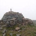
Summit cairn, Maol Chean-dearg.

and licensed for reuse under this Creative Commons Licence
Hover over the map markers to see associated photo. Note, some markers show photographer's position whilst others show photo subject location.
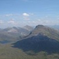
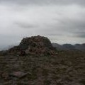
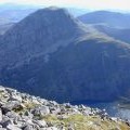
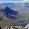
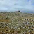
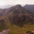
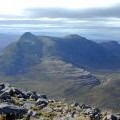
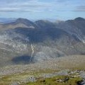
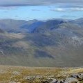
['Summit cairn, Maol Chean-dearg.',57.4916,-5.46548,'/public/geophotos/230008.jpg'],['Maol Chean-Dearg from Beinn Damh',57.4916,-5.46564,'/public/geophotos/347671.jpg'],['The summit cairn on Maol Chean-dearg',57.4919,-5.4655,'/public/geophotos/2732927.jpg'],['South from Maol Chean-dearg',57.4914,-5.46546,'/public/geophotos/527681.jpg'],['North west from Maol Chean-dearg',57.4918,-5.46516,'/public/geophotos/527674.jpg'],['The summit of Maol Chean-dearg',57.4916,-5.46497,'/public/geophotos/527654.jpg'],['Maol Chean-dearg for Sgorr Ruadh',57.4914,-5.46478,'/public/geophotos/1127906.jpg'],['West from Maol Chean-dearg',57.4919,-5.46467,'/public/geophotos/527663.jpg'],['East northeast from Maol Chean-dearg',57.4916,-5.46414,'/public/geophotos/1595718.jpg'],['View towards Fuar Tholl from Maol Chinn-dearg',57.4918,-5.46398,'/public/geophotos/1761610.jpg']