Sgurr a'Mhaim photos
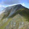
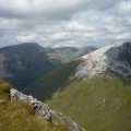
Sgùrr a' Mhaim and the Devil's Ridge

and licensed for reuse under this Creative Commons Licence
Hover over the map markers to see associated photo. Note, some markers show photographer's position whilst others show photo subject location.
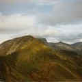
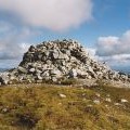
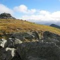
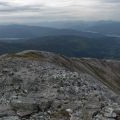
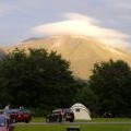
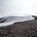
['Sgùrr a\' Mhaim and the Devil\'s Ridge',56.7559,-5.00363,'/public/geophotos/1598501.jpg'],['Sgùrr a\' Mhàim from Sgùrr an Iubhair',56.756,-5.0038,'/public/geophotos/1055171.jpg'],['Summit cairn of Sgùrr a\' Mhàim',56.7558,-5.00362,'/public/geophotos/2533167.jpg'],['Summit Cairn, Sgurr a Mhaim, 3,605 feet (1099 m)',56.7556,-5.00475,'/public/geophotos/68424.jpg'],['North ridge, Sgurr a\' Mhaim',56.7556,-5.00475,'/public/geophotos/238889.jpg'],['Sgurr a\' Mhaim from Glen Nevis Camp Site',56.7564,-5.00563,'/public/geophotos/504833.jpg'],['Quartzite screes cap Sgurr a\' Mhaim in the Mamores',56.7546,-5.00532,'/public/geophotos/2776327.jpg'],['The north ridge',56.757,-5.00585,'/public/geophotos/594337.jpg']