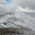
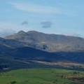
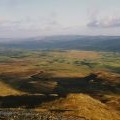
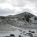
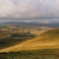
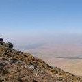
Arenig Fawr photos
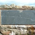
Flying Fortress memorial plaque

and licensed for reuse under this Creative Commons Licence

Hover over the map markers to see associated photo. Note, some markers show photographer's position whilst others show photo subject location.
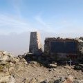
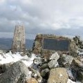
['Flying Fortress memorial plaque',52.9169,-3.74554,'/public/geophotos/649554.jpg'],['Arenig Fawr',52.9167,-3.74568,'/public/geophotos/372161.jpg'],['Triangulation pillar and B-17 memorial on the summit of Arenig Fawr',52.9167,-3.74568,'/public/geophotos/2328307.jpg'],['Flying Fortress memorial',52.9167,-3.74553,'/public/geophotos/372148.jpg'],['The Arenig from the Aran slopes',52.9169,-3.74658,'/public/geophotos/2657759.jpg'],['Arenig Fawr summit',52.9168,-3.74539,'/public/geophotos/1607589.jpg'],['View east from Arenig Fawr',52.9169,-3.74509,'/public/geophotos/2404949.jpg'],['Arenig Fawr',52.9176,-3.74482,'/public/geophotos/372194.jpg'],['North west from Arenig Fawr',52.9181,-3.74485,'/public/geophotos/2404942.jpg'],['The upper slopes of Arenig Fawr',52.9183,-3.745,'/public/geophotos/2328310.jpg']