Butser Hill photos
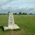
Trig point at the top of Butser Hill

and licensed for reuse under this Creative Commons Licence


Hover over the map markers to see associated photo. Note, some markers show photographer's position whilst others show photo subject location.
['Trig point at the top of Butser Hill',50.9778,-0.980496,'/public/geophotos/2921385.jpg'],['Butser Hill from Stoner Hill',50.9777,-0.980073,'/public/geophotos/39938.jpg'],['Butser Hill',50.9769,-0.980231,'/public/geophotos/2925165.jpg'],['Butser Hill',50.9777,-0.981497,'/public/geophotos/8087.jpg'],['Close-up of the radio mast on Butser Hill in 1983',50.9778,-0.98178,'/public/geophotos/2061910.jpg'],['Radio mast on Butser Hill (2010)',50.9774,-0.981788,'/public/geophotos/2050132.jpg'],['Radio mast on Butser Hill (1984)',50.9773,-0.981789,'/public/geophotos/2050123.jpg'],['Fence and radio mast on Butser Hill',50.9769,-0.981799,'/public/geophotos/2930747.jpg']