Long Knoll photos
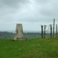
Flush bracket S1514 on Long Knoll trigpoint

and licensed for reuse under this Creative Commons Licence


Hover over the map markers to see associated photo. Note, some markers show photographer's position whilst others show photo subject location.
['Flush bracket S1514 on Long Knoll trigpoint',51.1374,-2.30697,'/public/geophotos/942656.jpg'],['Long Knoll from Grange Farm',51.1374,-2.30697,'/public/geophotos/1625453.jpg'],['West from Long Knoll to Glastonbury',51.1376,-2.30811,'/public/geophotos/946073.jpg'],['South from Long Knoll trigpoint',51.1366,-2.30667,'/public/geophotos/949350.jpg'],['Long Knoll summit.',51.1373,-2.30868,'/public/geophotos/83598.jpg'],['East from Long Knoll trigpoint',51.1374,-2.30539,'/public/geophotos/942702.jpg'],['Long Knoll summit',51.1364,-2.30867,'/public/geophotos/7863.jpg']