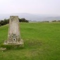
Pilsdon Pen photos
Pilsdon Pen from Lobb Gate

and licensed for reuse under this Creative Commons Licence


Hover over the map markers to see associated photo. Note, some markers show photographer's position whilst others show photo subject location.
['Pilsdon Pen from Lobb Gate',50.8067,-2.83344,'/public/geophotos/2164367.jpg'],['Trig point on Pilsdon Pen',50.8067,-2.83373,'/public/geophotos/2927962.jpg'],['The Orange Way in Dorset and Somerset (27)',50.8067,-2.83373,'/public/geophotos/3029978.jpg'],['View from Pilsdon Pen',50.8065,-2.83344,'/public/geophotos/970223.jpg'],['Trig point on Pilsdon Pen',50.8067,-2.83401,'/public/geophotos/2600165.jpg'],['Trig point at the summit of Pilsdon Pen',50.8065,-2.83443,'/public/geophotos/66999.jpg'],['Outer Ring at Pilsdon Pen',50.8059,-2.83272,'/public/geophotos/709431.jpg'],['Inside Pilsdon Pen',50.8076,-2.83459,'/public/geophotos/709425.jpg'],['Shelter belt',50.8065,-2.83528,'/public/geophotos/970732.jpg']