St Catherine's Hill photos
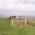
St Catherine Oratory and Trig point

and licensed for reuse under this Creative Commons Licence


Hover over the map markers to see associated photo. Note, some markers show photographer's position whilst others show photo subject location.
['St Catherine Oratory and Trig point',50.5932,-1.30416,'/public/geophotos/1102300.jpg'],['Chale: St. Catherine’s Oratory and coastal view',50.593,-1.3043,'/public/geophotos/1565607.jpg'],['Chale: looking up the oratory tower',50.593,-1.3043,'/public/geophotos/1565609.jpg'],['Chale: St. Catherine’s Oratory at Hallowe’en',50.593,-1.3043,'/public/geophotos/1565633.jpg'],['St Catherine\'s Oratory in 1988',50.593,-1.3043,'/public/geophotos/2778619.jpg'],['Tower of St Catherine\'s Oratory',50.5933,-1.30416,'/public/geophotos/1414112.jpg'],['The path to St. Catherine\'s Oratory',50.5928,-1.30431,'/public/geophotos/942984.jpg'],['Chale: footpath to the seaside',50.5926,-1.30488,'/public/geophotos/1565644.jpg'],['Trig Point on St Catherine\'s Hill',50.5925,-1.30488,'/public/geophotos/75851.jpg'],['Tumulus near St Catherine\'s Oratory and Trig Point',50.5925,-1.30488,'/public/geophotos/75860.jpg']