Viking Way photos
Road junction northeast of Buckminster

and licensed for reuse under this Creative Commons Licence


Hover over the map markers to see associated photo. Note, some markers show photographer's position whilst others show photo subject location.
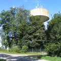
['Road junction northeast of Buckminster',52.8035,-0.681557,'/public/geophotos/805792.jpg'],['Hall Road near Buckminster',52.8035,-0.68215,'/public/geophotos/703028.jpg'],['Water Tower, Viking Way',52.8041,-0.682134,'/public/geophotos/544403.jpg'],['The Viking Way in northeast Leicestershire',52.8047,-0.681077,'/public/geophotos/805795.jpg']