Bass Rock photos
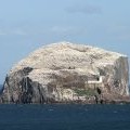
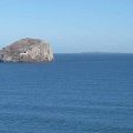
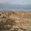
Bass Rock from Tantallon Castle

and licensed for reuse under this Creative Commons Licence

Hover over the map markers to see associated photo. Note, some markers show photographer's position whilst others show photo subject location.
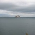
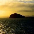
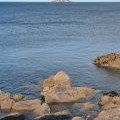
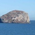
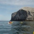
['Bass Rock from Tantallon Castle',56.0777,-2.641,'/public/geophotos/46757.jpg'],['Gannets on Bass Rock',56.0777,-2.641,'/public/geophotos/207842.jpg'],['Bass Rock from the Rosyth-Zeebrugge ferry',56.0777,-2.641,'/public/geophotos/280429.jpg'],['The Bass Rock',56.0777,-2.641,'/public/geophotos/2360406.jpg'],['The Bass Rock from North Berwick',56.0777,-2.641,'/public/geophotos/2443196.jpg'],['Bass Rock and the Isle of May',56.0777,-2.64068,'/public/geophotos/2903875.jpg'],['The Bass Rock from Seacliff',56.0773,-2.641,'/public/geophotos/2977478.jpg'],['Bass Rock',56.0779,-2.64036,'/public/geophotos/2903873.jpg'],['Crossing towards Bass Rock',56.0775,-2.64164,'/public/geophotos/1188950.jpg'],['Defoliated ground, Bass Rock',56.0776,-2.6402,'/public/geophotos/1189406.jpg']