Bromley Muir photos
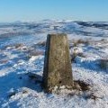
Bromley Muir Trig point

and licensed for reuse under this Creative Commons Licence


Hover over the map markers to see associated photo. Note, some markers show photographer's position whilst others show photo subject location.
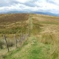
['Bromley Muir Trig point',55.9896,-4.61675,'/public/geophotos/1624900.jpg'],['Bromley Muir Trig point',55.9897,-4.61676,'/public/geophotos/1624898.jpg'],['Trig point on Bromley Muir',55.9897,-4.61659,'/public/geophotos/1036610.jpg'],['Looking northwest - Bromley Muir trig point',55.9897,-4.61659,'/public/geophotos/1036625.jpg'],['Moorland fence',55.9895,-4.61658,'/public/geophotos/2791095.jpg'],['Bromley Muir trig point',55.9898,-4.61661,'/public/geophotos/1703819.jpg'],['Dry stone wall disappearing under the grass',55.9909,-4.61764,'/public/geophotos/961086.jpg'],['Footpath on Bromley Muir',55.9912,-4.61766,'/public/geophotos/1666222.jpg'],['Footpath on Bromley Muir',55.9912,-4.61766,'/public/geophotos/1666224.jpg']