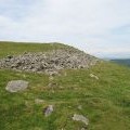
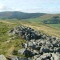
Cademuir Fort photos
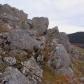
Rock outcrops near Cademuir summit

and licensed for reuse under this Creative Commons Licence
Hover over the map markers to see associated photo. Note, some markers show photographer's position whilst others show photo subject location.
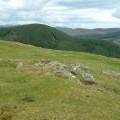
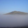
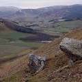
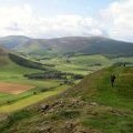
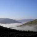
['Rock outcrops near Cademuir summit',55.6239,-3.22353,'/public/geophotos/2216935.jpg'],['Summit 407m on Cademuir west ridge',55.6247,-3.22339,'/public/geophotos/909265.jpg'],['Cademuir Hill fort',55.6249,-3.2234,'/public/geophotos/758813.jpg'],['The steep side of Cademuir Hill',55.6233,-3.22367,'/public/geophotos/2216927.jpg'],['Cademuir Ridge',55.624,-3.2248,'/public/geophotos/1458526.jpg'],['Hillfort, Cademuir Hill',55.6252,-3.22293,'/public/geophotos/1209895.jpg'],['Inversion',55.6244,-3.22211,'/public/geophotos/744367.jpg'],['North side of Cademuir Hill fort',55.6247,-3.2253,'/public/geophotos/962582.jpg']