Carn Geuradainn East Top photos
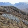
A slanting landscape seen from Carn Geuradainn

and licensed for reuse under this Creative Commons Licence
Hover over the map markers to see associated photo. Note, some markers show photographer's position whilst others show photo subject location.
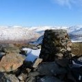
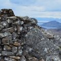
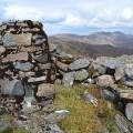
['A slanting landscape seen from Carn Geuradainn',57.4043,-5.35962,'/public/geophotos/2946538.jpg'],['Stone built trig point at summit of Carn Geuradainn (594m)',57.4036,-5.36239,'/public/geophotos/1282867.jpg'],['Summit trig point, Carn Geuradainn',57.4039,-5.36275,'/public/geophotos/2946525.jpg'],['Summit of Carn Geuradainn',57.4039,-5.36275,'/public/geophotos/2946528.jpg']