Craigendarroch photos
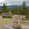
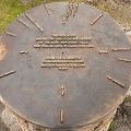
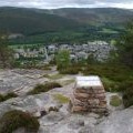
Craigendarroch - viewpoint indicator

and licensed for reuse under this Creative Commons Licence
Hover over the map markers to see associated photo. Note, some markers show photographer's position whilst others show photo subject location.
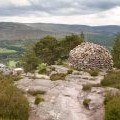
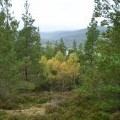
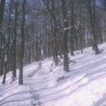
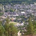
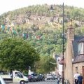
['Craigendarroch - viewpoint indicator',57.0554,-3.0475,'/public/geophotos/847865.jpg'],['Craigendarroch - viewpoint indicator plate',57.0554,-3.04733,'/public/geophotos/847869.jpg'],['Cairn on Craigendarroch',57.055,-3.04715,'/public/geophotos/847849.jpg'],['Looking west up Deeside from Craigendarroch hill, Ballater',57.0555,-3.04849,'/public/geophotos/2264469.jpg'],['Woods on Craigendarroch',57.0552,-3.04848,'/public/geophotos/30913.jpg'],['Ballater from Craigendarroch Hill',57.0552,-3.04848,'/public/geophotos/101200.jpg'],['Craigendarroch Hill',57.0552,-3.04848,'/public/geophotos/135847.jpg'],['Craigendarroch - overlooking Ballater',57.0548,-3.04665,'/public/geophotos/847858.jpg']