Lendrick Hill photos
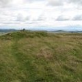
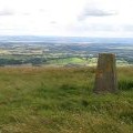
Summit area of Lendrick Hill

and licensed for reuse under this Creative Commons Licence

Hover over the map markers to see associated photo. Note, some markers show photographer's position whilst others show photo subject location.
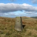
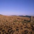
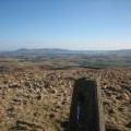
['Summit area of Lendrick Hill',56.2155,-3.58336,'/public/geophotos/2151668.jpg'],['Thornton Hill summit',56.2154,-3.58303,'/public/geophotos/554296.jpg'],['Lendrick Hill cairn',56.2166,-3.58341,'/public/geophotos/231953.jpg'],['Summit of Thornton Hill',56.2148,-3.58333,'/public/geophotos/36380.jpg'],['Lendrick Hill trig point',56.2148,-3.58333,'/public/geophotos/1725223.jpg'],['Thornton Hill: the trig point',56.2149,-3.58285,'/public/geophotos/554299.jpg']