Meall a'Chrasgaidh photos
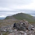
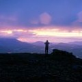
Summit of Meall a' Chrasgaidh

and licensed for reuse under this Creative Commons Licence
Hover over the map markers to see associated photo. Note, some markers show photographer's position whilst others show photo subject location.
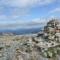
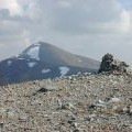
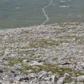
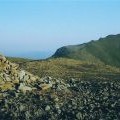
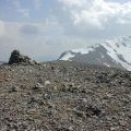
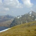
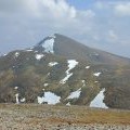
['Summit of Meall a\' Chrasgaidh',57.7127,-5.04876,'/public/geophotos/894421.jpg'],['Summit of Meall a\' Chrasgaidh',57.7126,-5.04841,'/public/geophotos/1721726.jpg'],['Stoney ground on Meall a\' Chrasgaidh',57.7131,-5.04913,'/public/geophotos/908089.jpg'],['The Fannichs',57.7125,-5.04841,'/public/geophotos/1071276.jpg'],['Summit of Meall a\' Chrasgaidh',57.7125,-5.04823,'/public/geophotos/483375.jpg'],['Northern Fannichs, from Meall a\' Chrasgaidh',57.7131,-5.04778,'/public/geophotos/483384.jpg'],['The summit cairn of Meall a\'Chrasgaidh.',57.7118,-5.04835,'/public/geophotos/213603.jpg'],['View towards Sgùrr Mòr',57.7124,-5.04772,'/public/geophotos/1721727.jpg'],['Sunset over An Teallach',57.7127,-5.0501,'/public/geophotos/1598906.jpg']