Pannanich Hill photos
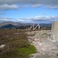
Track leading to Pannanich Hill

and licensed for reuse under this Creative Commons Licence


Hover over the map markers to see associated photo. Note, some markers show photographer's position whilst others show photo subject location.
['Track leading to Pannanich Hill',57.0361,-3.00246,'/public/geophotos/548787.jpg'],['Summit of Pannanich Hill',57.0363,-3.00247,'/public/geophotos/548778.jpg'],['Cairn on summit of Pannanich Hill',57.0365,-3.00165,'/public/geophotos/548795.jpg'],['Conifer on summit of Pannanich Hill at 600 metres',57.0369,-3.00166,'/public/geophotos/548808.jpg']