Craig Berwyn (boundary) photos
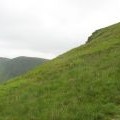
Approaching the top of the 'tiger' path

and licensed for reuse under this Creative Commons Licence
Hover over the map markers to see associated photo. Note, some markers show photographer's position whilst others show photo subject location.
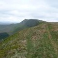
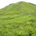
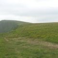
['Approaching the top of the \'tiger\' path',52.8917,-3.3741,'/public/geophotos/471288.jpg'],['Path along the Berwyn ridge',52.8906,-3.37496,'/public/geophotos/1890014.jpg'],['Climbing up the Berwyn scarp from the Tomle col',52.8918,-3.37187,'/public/geophotos/469890.jpg'],['The ridge regained',52.8919,-3.37529,'/public/geophotos/471294.jpg']