Totridge photos
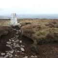
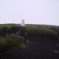
Trig pillar, Totridge

and licensed for reuse under this Creative Commons Licence

Hover over the map markers to see associated photo. Note, some markers show photographer's position whilst others show photo subject location.
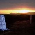
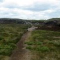
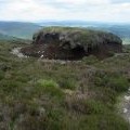
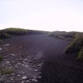
['Trig pillar, Totridge',53.9334,-2.55818,'/public/geophotos/1828187.jpg'],['Trig point Totridge at sunset',53.9332,-2.55802,'/public/geophotos/991461.jpg'],['Approaching the Summit of Totridge',53.9331,-2.55802,'/public/geophotos/1929041.jpg'],['Peat Hagg on Totridge',53.9343,-2.55804,'/public/geophotos/1929048.jpg'],['Trig Pillar , Totridge',53.9331,-2.55741,'/public/geophotos/194220.jpg'],['Trig Point on Totridge with Pendle in the distance',53.9331,-2.55894,'/public/geophotos/128605.jpg'],['Peat Hagg',53.9322,-2.5574,'/public/geophotos/194222.jpg']