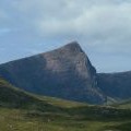
Sgurr an Fhidhleir photos
Sgurr an Fhidhleir

and licensed for reuse under this Creative Commons Licence
Hover over the map markers to see associated photo. Note, some markers show photographer's position whilst others show photo subject location.
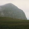
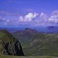
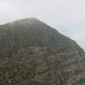
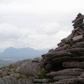
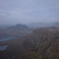
['Sgurr an Fhidhleir',57.9972,-5.22577,'/public/geophotos/877177.jpg'],['The Fiddler and the Inverpolly Hills',57.9968,-5.22659,'/public/geophotos/1757162.jpg'],['Sgurr anFhidhleir.',57.9978,-5.22498,'/public/geophotos/9500.jpg'],['Summit Cairn, Sgurr an Fhidhleir',57.9978,-5.22498,'/public/geophotos/52984.jpg'],['Sgurr an Fhidleir',57.998,-5.22449,'/public/geophotos/2449653.jpg'],['Stac Pollaidh from Sgurr an Fhidleir',57.9959,-5.22819,'/public/geophotos/295804.jpg']