Foel Grach photos
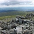
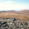
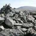
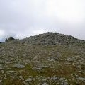
Foel Grach summit cairn

and licensed for reuse under this Creative Commons Licence
Hover over the map markers to see associated photo. Note, some markers show photographer's position whilst others show photo subject location.
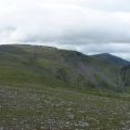
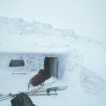
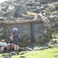
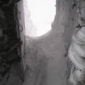
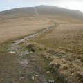
['Foel Grach summit cairn',53.1741,-3.96323,'/public/geophotos/205528.jpg'],['Carnedd Llewelyn from Foel Grach Summit',53.1741,-3.96323,'/public/geophotos/223069.jpg'],['Foel Grach',53.174,-3.9629,'/public/geophotos/76787.jpg'],['Foel Fras from Foel Grach',53.1738,-3.96304,'/public/geophotos/75329.jpg'],['The refuge in the lee of the summit of Foel Grach',53.1745,-3.96292,'/public/geophotos/910526.jpg'],['Foel Grach summit cairn',53.1734,-3.96332,'/public/geophotos/3018414.jpg'],['No view from the refuge',53.1745,-3.96277,'/public/geophotos/2122786.jpg'],['Retrospect of Foel Grach',53.1744,-3.96382,'/public/geophotos/3018424.jpg'],['The summit of Foel Grach',53.1739,-3.96409,'/public/geophotos/515268.jpg'],['Foel Grach from Gwaun y Garnedd',53.1741,-3.96455,'/public/geophotos/515253.jpg']