Hatterrall Hill photos
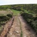
Offa's Dyke Path

and licensed for reuse under this Creative Commons Licence

Hover over the map markers to see associated photo. Note, some markers show photographer's position whilst others show photo subject location.
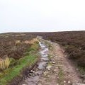
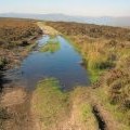
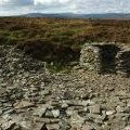
['Offa\'s Dyke Path',51.9256,-3.00744,'/public/geophotos/817753.jpg'],['Hatterrall Hill (2)',51.9255,-3.00627,'/public/geophotos/168388.jpg'],['Track across the top of Hatterrall Hill',51.9257,-3.00627,'/public/geophotos/2229319.jpg'],['Old quarry, Hatterrall Hill',51.9264,-3.00687,'/public/geophotos/2119995.jpg'],['Hatterrall Ridge looking north',51.9263,-3.00832,'/public/geophotos/312853.jpg']